RESOURCES
- The North Capitol Hill Neighborhood Association (NCHNA)
- Seattle Transit History
- HistoryLink.org essay on the North Capitol Hill, Roanoke Park, & Portage Bay Communities
- Roanoke Park Historic District National Register Nomination Form (pdf 4mb)
Links to external websites do not constitute endorsement by WSDOT of the linked websites or the opinions, information, products or services contained therein
The neighborhood which would become Roanoke Park was originally platted under the partnership of David Denny and Henry Fuhrman in 1890. Roanoke Park is bounded by East Shelby Street in the north, Harvard Avenue East to the west, East Roanoke Street to the south, and Tenth Avenue East to the east. The community is perched on a relatively flat plateau with precipitous drops on three sides and a steep upward slope to the south toward Capitol Hill. As a result, the neighborhood stands separate from the surrounding residential areas.
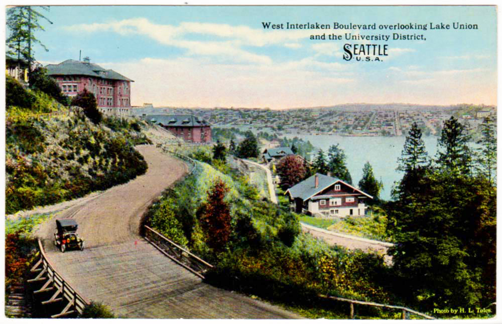
The first development in the area was an electric trolley line built by Denny in 1891. A branch from the Eastlake line, the trolley line ran up Broadway, terminating at East Lynn Street. Shortly thereafter, the first home was constructed in Roanoke Park in 1899. However, it was not until after the turn of the century that the area saw more significant development.
In 1908, the trolley line was extended through the neighborhood and out to the north, connecting again with the Eastlake line and a line continuing northward toward the University of Washington campus. Around this same time, Roanoke Park was established. Attracted by the transportation options and elegant park, many homes were soon built for Seattle’s influential elite in Roanoke Park. Often designed by notable local architects, the homes reflected a diverse collection of early twentieth century architecture. Thus, Roanoke Park emerged as an early street car suburb of Seattle, attractive for its public spaces and transportation links to downtown.
The North Capitol Hill neighborhood was named by the neighborhood’s primary developer, James Moore, in 1901. Prior to this, the area had been known as Broadway Hill and was positioned around a wagon road cut through the forest to a cemetery at its peak, later named Lake View Cemetery.
Moore was a very successful developer who marketed the exclusive character of the area to attract Seattle’s elite to the neighborhood. By 1913, enough mansions lined 14th Avenue North to earn it the nickname “Millionaire’s Row.” Each estate was individually designed, primarily by well‑known architects, in lavish grandeur and in a wide range of architectural styles.
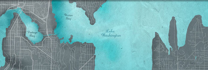
As transportation improved, the Capitol Hill neighborhood became accessible to Seattle residents and grew rapidly as a result. The character of the neighborhood began to change from single family, elegant homes, to eventually include numerous multifamily structures. The neighborhood of Portage Bay extends along the western shore of Union Lake’s eastern arm. This portion of the lake was named “Portage Bay” by the Seattle Port Commission in 1913 to prevent confusion with the more popularly known main portion of the lake. The Portage Bay neighborhood developed along the edge of this bay, occupying the lower topography of today’s Fuhrman Ave East and Boyer Avenue East (originally platted 12th Avenue East), north of SR 520 and east of I-5.
Like Roanoke Park, the Portage Bay area was originally platted in the early 1890s under the partnership of David Denny and Henry Fuhrman. The land located south of East Shelby Street, along Boyer Avenue East, west to 11th Avenue East and south to East Edgar Street, was first platted by Cheshiahud, a local Native American resident, also known as Lake Union John. The platted land, known as John’s Addition, was originally homesteaded by Cheshiahud who lived on five acres of Lake Union shoreline until shortly after his wife’s death in 1906. Thereafter, Cheshiahud joined the flight of many other Native Americans from the Seattle area, primarily caused by the disruptions that increasing settlement by non-natives, treaties, and discriminatory laws had on traditional subsistence patterns, village locations, and social networks. Cheshiahud sold his land, making him one of the richest Native Americans in Puget Sound, and moved to the Port Madison Reservation.
Visit Historylink.org toread more about the The North Capitol Hill, Roanoke Park, & Portage Bay Communities.